Data
Data
|
NBDC National Buoy Data Center Links
(west to east, buoys have wave data) || Toledo | Toledo_Water_Intake_Buoy | Toledo Lt No. 2 | | S_Bass_I | Marblehead | Huron | W_Erie_Buoy | | Lakewood_Buoy | Cleveland_Intake_Crib_Buoy | Cleveland || || Fairport || || Geneva | Conneaut | Port_Stanley_Buoy | Erie_PA_Buoy | Erie | | Dunkirk | Port_Colborne_Buoy | Sturgeon_Point | Buffalo || |
| WIND |
W_Erie_Buoy |
Cleveland_Buoy |
Euclid_Buoy |
Cleveland_Crib_Buoy |
** Fairport ** |
Geneva |
Port_Stanley_Buoy |
Erie_PA_Buoy |
Port_Colborne_Buoy |
| WAVES |
|
|
|
|
No Wave Data |
No Wave Data |
|
|
|
|
|
More up to the minute wind data frm NOAA |
|| Toledo | Marblehead | Cleveland | **Fairport** | Erie, PA | Buffalo, NY || |
| Water Levels | Water Flow | |||

|
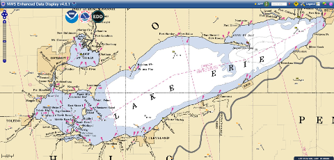
Current Levels Grand River, OH History and Forecast USACE Water Level Forecast Page Current Monthly Bulletin |
|
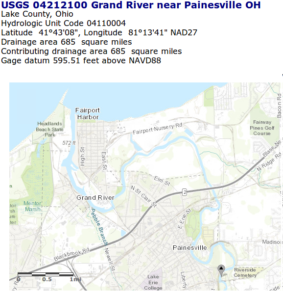
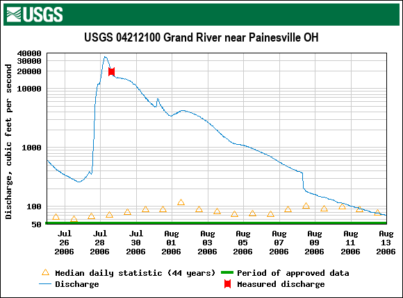
USGS Water Flow Data USGS 04212100 Grand River near Painesville OH Current Gauge Data Searchable Historic Data Gauge Information Data Showing Flood of 2006 |
|
NOAA Interactive Weather Maps With Radar Overlay |
|
Surface Temp
72hr Loop |
Bottom Temp
. |
Wind and Currents
72hr Loop |
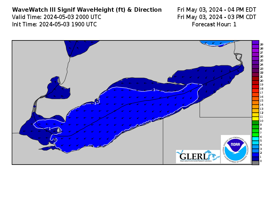
Wave Height
Loop |
Water Level Displ
Loop |
|
Great Lakes Surface Analysis |
Lake Erie Ice Cover |
Lake Erie Ice Thickness |
Lake Erie Ice Velocity |
Lake Erie Waves and Ice |

|

|

|

|
|
|
10 Day Forecast Toledo, OH Cleveland, OH Mentor Headlands, OH Erie, PA Buffalo, NY |
Forecast Map
|
Sky Conditions
|
